All Projects
Product
Relic Route
Discover history beneath your feet
Mobile AppLiDARMachine LearningMapsUX
Overview
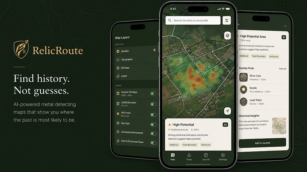
A product-led exploration of how data, maps and AI can help detectorists discover legal, historically promising search locations — combining LiDAR, historic maps and machine learning in a mobile app.
4+
Data Sources
12
Scoring Factors
Historic & Modern
Map Layers
The Problem
Metal detectorists spend hours searching locations with little historical context, leading to low find rates and wasted time. Existing tools offer basic maps but no intelligent analysis of where finds are most likely.
The Process
- Product strategy and market research
- UX design and user journey mapping
- Technical architecture for LiDAR and map data integration
- Scoring algorithm development
- Mobile experience design and development
- Beta testing with detectorist community
The Outcome
A full end-to-end product including product strategy, UX, technical architecture, mapping, scoring algorithms and mobile experience.